Water Shapes Earth is a project that shows abstract aerial shots of water on Earth bringing attention to climate change and our destructive ways that shape and destroy our planet. Each photo is accompanied by a story that speaks of historical deeds that led to such sight in the present time. “Project combines the power of aerial photography and storytelling to rediscover the beauty of our planet.” In hopes of inspiring awe and provoking the public to face the truth. “Bordering between document and painting-like abstractions new perspective stimulate a process of thinking about something essential to our survival, something we often take for granted – until it’s gone. If we don’t act responsibly, one day water will disappear, and we will see only the traces of it. Our goal is to open new perspectives while sharing stories, revealing places, and changing minds a bit.”
More info: Water Shapes Earth.
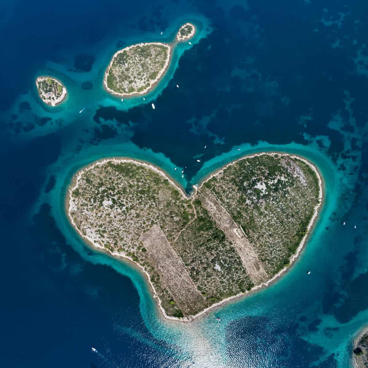
GALEŠNJAK ISLAND, Croatia
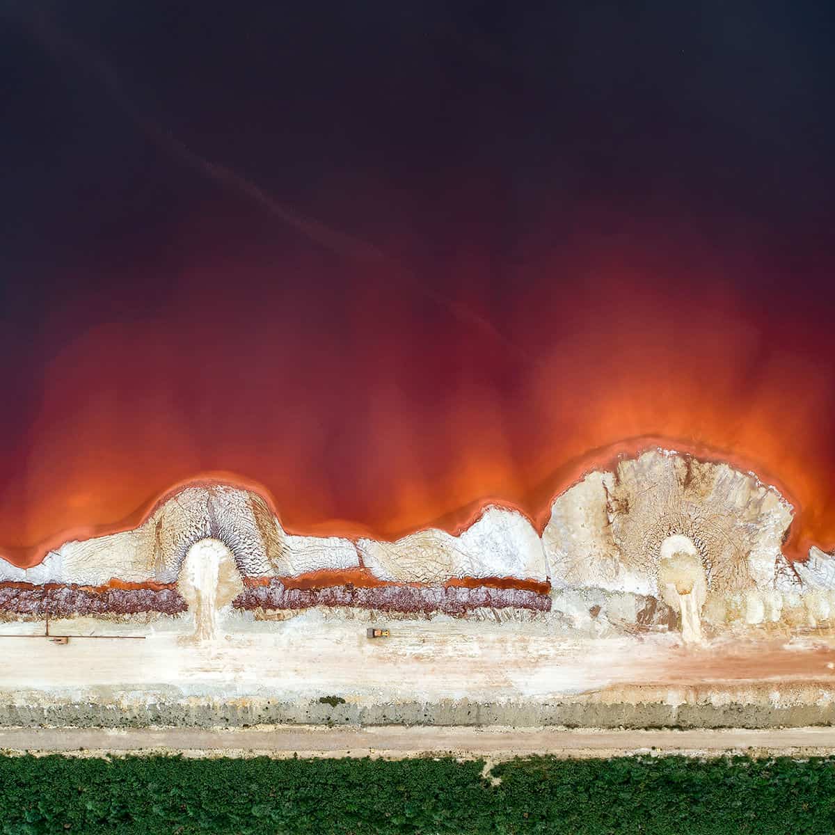
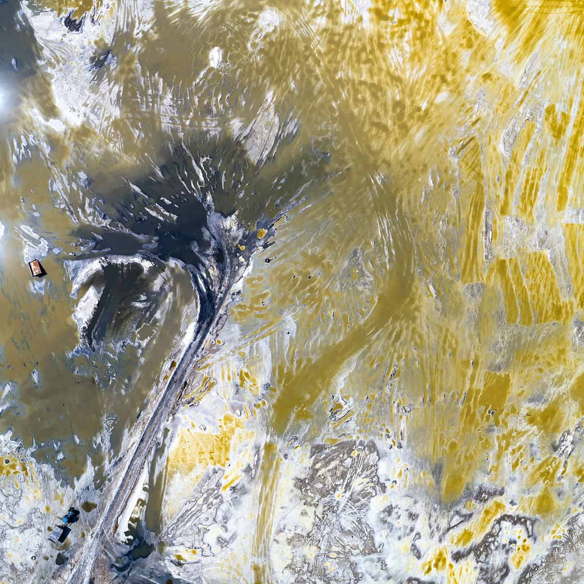
RED MUD STORAGE POND – In order to prevent dangerous leaks, bulldozers work on weekends and holidays, shoring up the dam where toxic waste from aluminum production is stored in Galicia, Northern Spain, near San Cibrao.
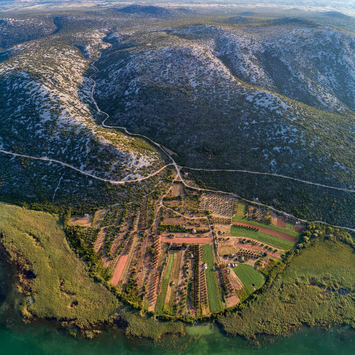
FARMLANDS SHAPED BY FORMER ESTUARY, Croatia, Vransko Jezero, Biograd – A great depiction of how water shapes our earth and influences agriculture. Amongst the dry hills, the former estuary of a former stream left sediments full of nutrients.
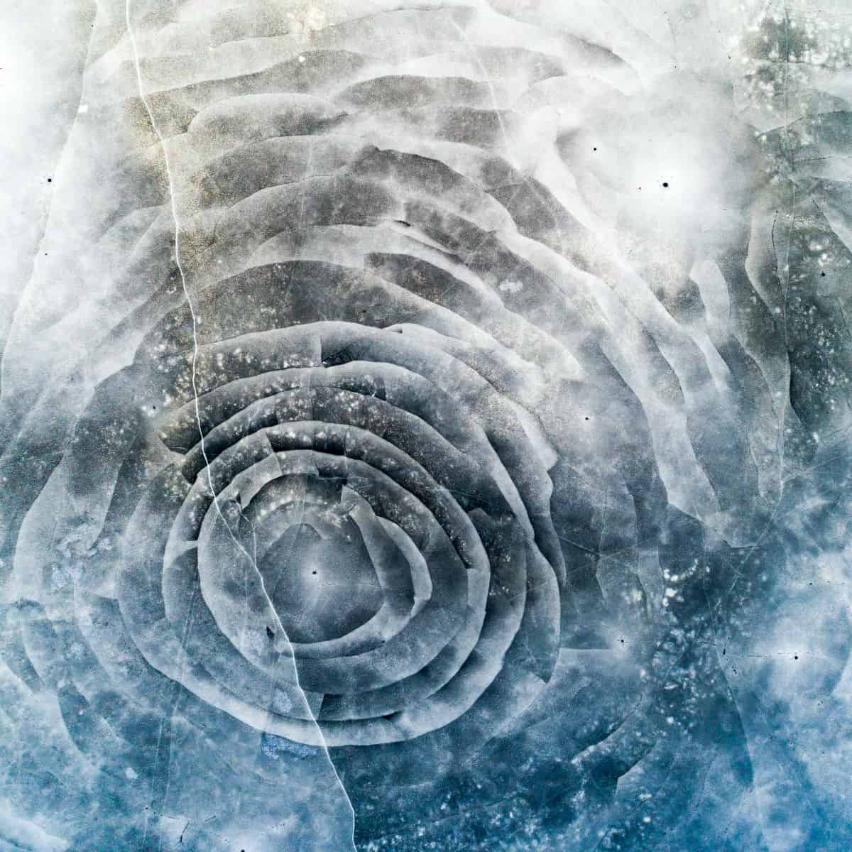
ROSE SHAPED ICE CRACK – Ackers, Sweden
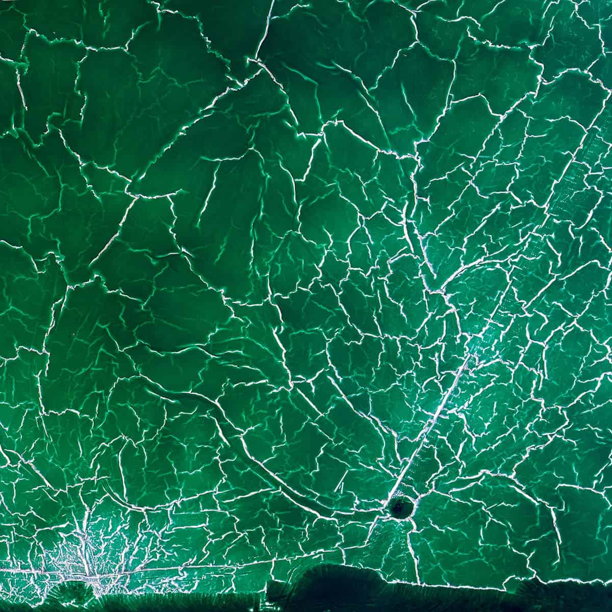
RADIOACTIVE WATER – Textures at an abandoned pond used for the disposal and stacking of phosphogypsum with shallow, but highly toxic radioactive green water in Huelva, Southern Spain.
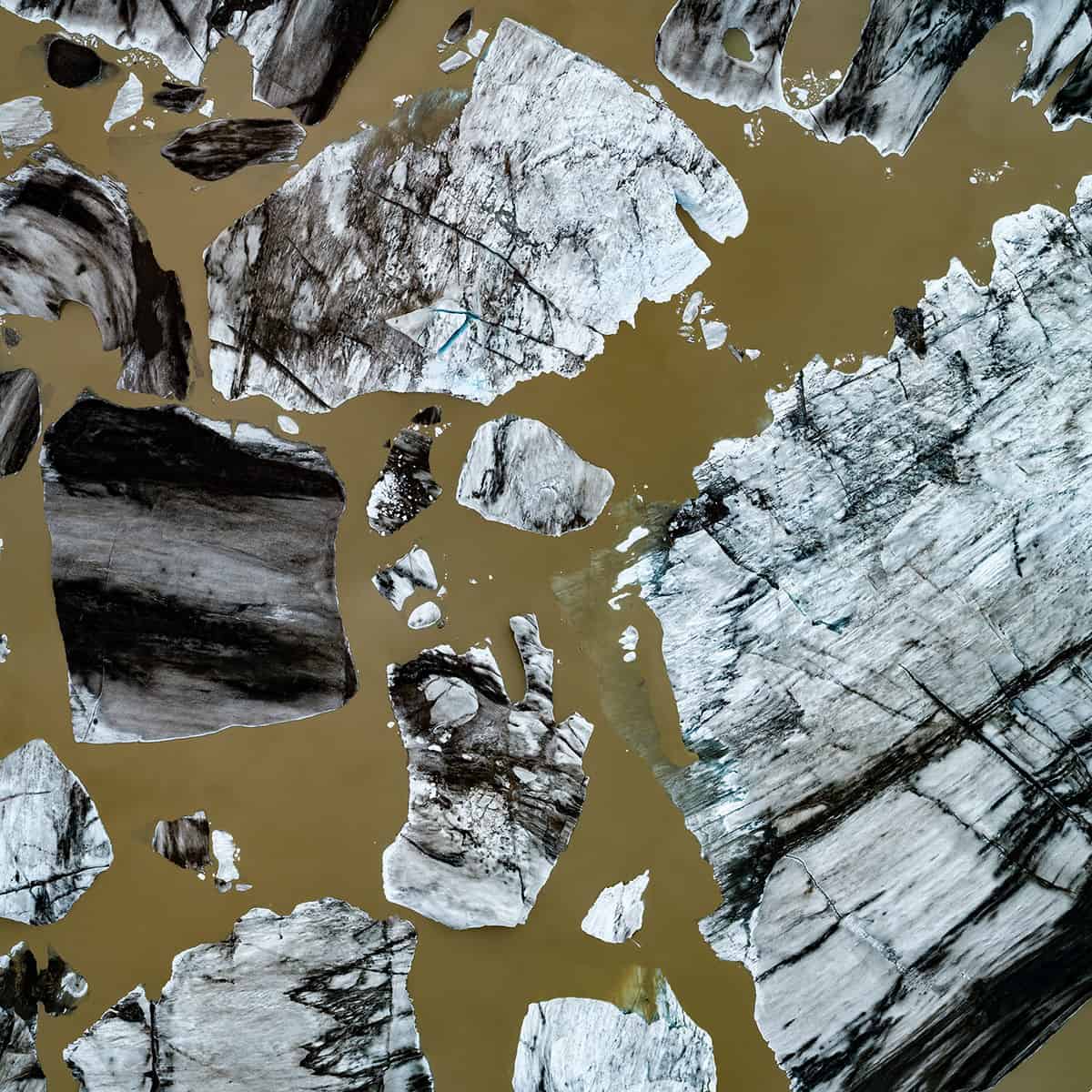
FLOATING ICEBERGS – Giant pieces of melting ice, remnants of the collapsing glacier, float motionlessly in the mud-colored brown glacier lake until they vanish forever. Hoffellsjökull, Iceland.
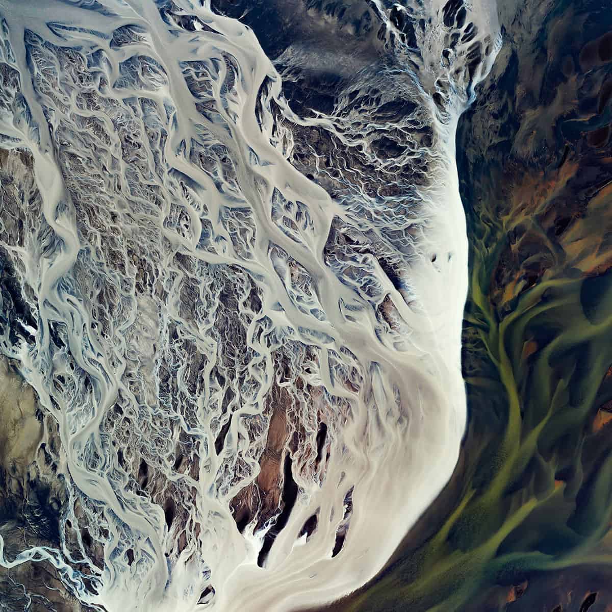
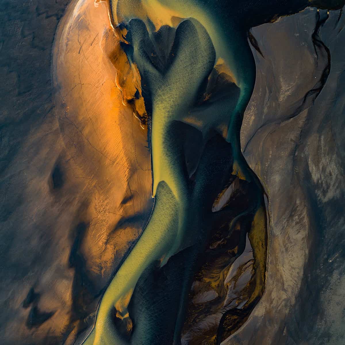
ESTUARY OF RIVER AFFALL – Where the Affall River meets the Atlantic Ocean, there is a confluence of three colored tributaries that wind through various farmlands. Together they casually flow to the ocean across the black sandy beach. Landeyjar area, Southern Iceland
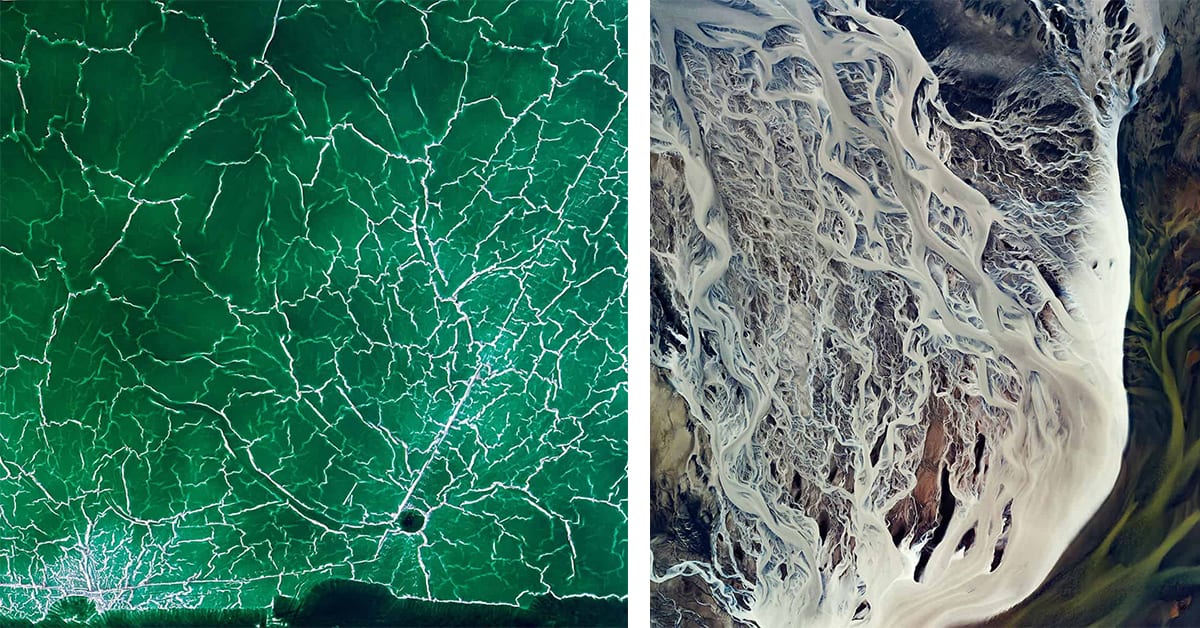
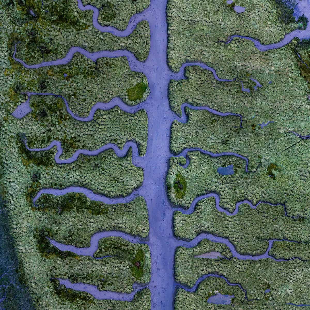
SALTY MARSH – Low tide at blue hour reveals a muddy riverbed of fishbone shaped streams in the middle of a small, but unique part of the salt marsh located at the end of the Betanzos Estuary, near Coruna in northern Spain.
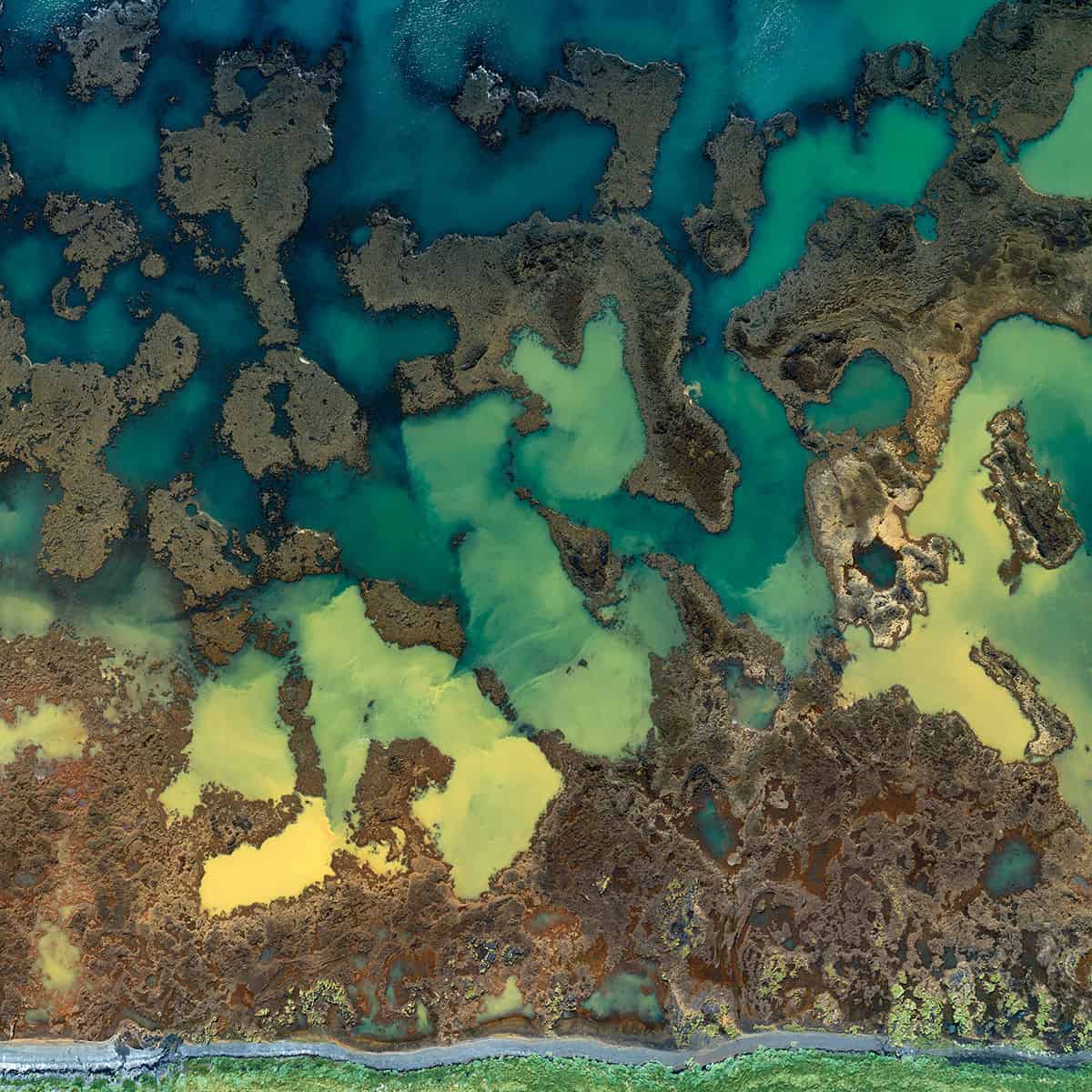
LAVA FLOW AND SEA – Yellow sediments delivered from farmland by small streams mix with the vivid blue ocean among the rustic islands created by lava flows in Southern Iceland, near the town of Stokkseyri.
SALT LAKE MIRZALADI – Traces of destruction along the almost empty, fully exploited natural salt lake at the end of the summer season on Lake Mirzaladi, in Azerbaijan.
SANDY ISLANDS – Skaftá River crosses a lava field on its way towards the sea, and over the decades it has leveled the area with mud from glacial meltwater. During low level periods in the summer, sandy islands with dried-out bushes, the result of glacial outburst flooding, emerge. Katla Geopark, Iceland
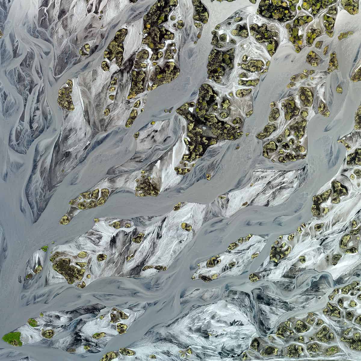
CONFLUENCE – Glacial river veins of Geirlandsá and Stjórm near Kirkjubaejarklaustur village, braiding their way through black volcanic sand, constantly creating new paths, intricately intertwined, and depositing nutrients of various colors from melting glaciers. Iceland, Southern Region.